
Organizations across industries are increasingly relying on location intelligence, creating strong demand for geo-information science jobs. Government agencies, technology companies, transportation providers, healthcare organizations, utilities, agriculture, and environmental firms all use geospatial data to improve planning, operations, and decision-making. As digital mapping technologies continue to advance, GIS careers have become an important part of many sectors.
Whether you’re a student exploring career options or a professional considering a career change, the GIS field offers diverse opportunities with long-term growth potential. From mapping and spatial analysis to software development and urban planning, there are multiple paths to pursue. This guide covers the most common geo information science jobs, the skills employers value, salary expectations, and where to find career opportunities in today’s geospatial industry.
What Are Geo Information Science Jobs?
Geo Information Science (GIScience) is the study and use of technologies that collect, manage, analyze, and visualize geographic information. Professionals in this field work with spatial data to identify patterns, solve location-based problems, and support better decision-making across different industries. GIScience combines science, technology, and data analysis to turn geographic information into practical insights.
While GIS and geography are closely connected, they serve different purposes. Geography focuses on understanding the Earth’s physical features, environments, and human activities, whereas Geographic Information Systems (GIS) is the technology used to capture, store, analyze, and display geographic data. This technology-driven approach has created a wide range of geographic information systems careers.
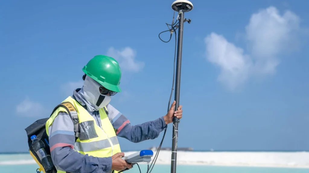
Today, GIS professionals use mapping software, spatial analysis, databases, GPS, and remote sensing tools to support projects in transportation, urban planning, agriculture, environmental management, public safety, and utilities. Their work helps organizations improve planning, manage resources more efficiently, and make informed decisions based on accurate location data.
Types of Geo Information Science Jobs

Geo information science offers a variety of career paths based on your skills and interests. Some roles focus on mapping and data analysis, while others involve software development, remote sensing, or project management. Here are some of the most common options.
1. GIS Analyst
GIS Analysts collect and analyze geographic data, create maps, and perform spatial analysis. They commonly work for government agencies, engineering firms, environmental organizations, and utility companies. The average salary typically ranges from $60,000 to $90,000 per year.
2. GIS Technician
GIS Technicians organize, update, and maintain spatial data while assisting with map creation and database management. This is a popular entry-level role for those starting a career in GIS.
3. GIS Developer
GIS Developers build geospatial applications and automate workflows using Python, JavaScript, and SQL. They combine programming skills with GIS technology to develop mapping solutions.
4. Remote Sensing Analyst
Remote Sensing Analysts use satellite imagery, drone mapping, and Earth observation data to study land, natural resources, and environmental changes.
5. Cartographer
Cartographers create digital maps and visualizations that present geographic information clearly. They focus on map design, accuracy, and data visualization.
6. Geospatial Data Scientist
Geospatial Data Scientists use AI, machine learning, and big data to analyze location-based information and develop predictive mapping models.
7. GIS Project Manager
GIS Project Managers lead geospatial projects by managing teams, planning timelines, and coordinating with clients to ensure successful project delivery.
Industries Hiring GIS Professionals
The demand for GIS professionals continues to grow as more industries rely on location-based data for planning and decision-making. Government agencies use GIS for land management and public services, while environmental consulting firms support conservation and sustainability projects. Urban planning, construction, and smart city initiatives also depend on geospatial technology to design and manage infrastructure.
Other major employers include the oil and gas, renewable energy, telecommunications, agriculture, transportation, logistics, utilities, public safety, and defense sectors. Technology companies also hire GIS specialists to develop mapping platforms, location-based applications, and geospatial analytics solutions.
Skills Needed for GIS Jobs
GIS professionals need a mix of technical knowledge and soft skills to analyze geographic data, create accurate maps, and solve location-based problems.
Technical Skills
- ArcGIS and QGIS for mapping and spatial analysis
- Python and SQL for automation, data management, and programming
- Spatial databases for storing and managing geographic information
- Remote sensing for analyzing satellite and aerial imagery
- GPS technology for location data collection and accuracy
- Cartography for map design and visualization
- Geospatial analysis for identifying patterns and trends
- Data visualization for presenting spatial insights clearly
- Cloud GIS for managing and analyzing geospatial data online
Soft Skills
- Communication skills
- Problem-solving abilities
- Critical thinking
- Teamwork and collaboration
- Attention to detail
Education and Certifications
Most geo information science jobs require a bachelor’s degree in Geographic Information Systems, Geography, Geomatics, Environmental Science, Computer Science, or a related field. A master’s degree can be beneficial for research, leadership, or specialized positions, but it is not mandatory for most roles.
Professional certifications can strengthen your resume and demonstrate technical expertise. Popular options include Esri Technical Certification, GIS Professional (GISP) certification, Google GIS-related certificate programs, and GIS courses offered through platforms like Coursera.
Salary Expectations for Geo Information Science Jobs
Salaries for geo information science jobs vary depending on factors such as experience level, location, certifications, employer, and industry. Professionals with advanced technical skills, programming knowledge, and specialized expertise often earn higher salaries.
| Role | Average Salary (Per Year) |
| GIS Technician | $45,000 – $65,000 |
| GIS Analyst | $60,000 – $90,000 |
| GIS Developer | $75,000 – $110,000 |
| Cartographer | $55,000 – $85,000 |
| GIS Project Manager | $85,000 – $120,000 |
| Geospatial Data Scientist | $90,000 – $130,000 |
Salary ranges may differ based on geographic location, years of experience, industry demand, employer size, and professional certifications.
Specialized skills in programming, artificial intelligence, remote sensing, and advanced spatial analysis can also improve career growth and earning potential.
Where to Find GIS Jobs
Finding the right GIS opportunity requires using reliable job platforms and industry-specific resources. Many organizations post GIS jobs on professional networking sites, career websites, and specialized geospatial platforms.
- LinkedIn: A popular platform for finding GIS roles, networking with industry professionals, and connecting with recruiters.
- Indeed: Offers a wide range of GIS positions, including entry-level and experienced opportunities.
- Glassdoor: Helps job seekers explore GIS openings along with company reviews and salary insights.
- Google Careers: Candidates interested in technology-focused roles can search for Google GIS jobs and related geospatial positions.
- Government Job Portals: Government agencies frequently hire GIS professionals for planning, environmental management, defense, and public services.
- Esri Careers: Esri and its partner organizations regularly post opportunities related to GIS software, mapping, and geospatial technology.
- University Career Portals: Many universities share GIS internships, research positions, and entry-level opportunities for graduates.
Using multiple platforms, building a strong GIS portfolio, and keeping technical skills updated can help candidates discover more career opportunities in the growing geospatial industry.
Career Growth and Future Outlook
The career path in geo information science offers opportunities for continuous growth as professionals gain experience and develop advanced technical skills. Many GIS professionals begin as GIS Technicians, move into GIS Analyst roles, and progress toward senior positions such as Senior GIS Analyst, GIS Developer, GIS Manager, Geospatial Data Scientist, and Director of GIS.
Demand for GIS careers is expected to grow as organizations increasingly depend on location-based insights. Advancements in artificial intelligence (AI), smart cities, climate research, digital twins, autonomous vehicles, and infrastructure planning are creating new opportunities for geospatial experts.
Professionals who combine GIS knowledge with programming, data science, and emerging technologies will have strong career potential in the evolving geospatial industry.
Tips for Landing Geo Information Science Jobs
Building a successful career in GIS requires technical skills, practical experience, and continuous learning. Follow these steps to improve your chances of securing a geo information science role:
- Build a GIS portfolio: Create maps, spatial analysis projects, and real-world case studies to showcase your skills to employers.
- Learn Python: Programming knowledge helps automate GIS tasks, manage data, and develop advanced geospatial solutions.
- Earn certifications: Professional certifications can strengthen your resume and demonstrate expertise in GIS tools and technologies.
- Practice ArcGIS: Gain hands-on experience with industry-standard software used by many GIS employers.
- Create GitHub projects: Share GIS scripts, data analysis projects, and mapping applications to highlight your technical abilities.
- Network on LinkedIn: Connect with GIS professionals, recruiters, and industry groups to discover new opportunities.
- Apply for internships: Internships provide practical experience and help build professional connections.
- Stay updated with GIS trends: Follow developments in AI, remote sensing, cloud GIS, and geospatial technologies to remain competitive.
FAQs
GIScience focuses on the concepts, methods, and technologies behind managing and analyzing geographic information, while GIS is the practical system used for creating, storing, and visualizing spatial data. GIScience provides the foundation that supports GIS applications.
Yes, some entry-level GIS roles may be available without a specialized degree if you have strong technical skills, certifications, and a practical portfolio. Knowledge of tools like ArcGIS, QGIS, and Python can improve your chances.
Yes, many GIS roles offer remote or hybrid work options, especially positions involving data analysis, mapping, programming, and geospatial database management. Availability depends on the employer and job requirements.
ArcGIS is one of the most widely used GIS platforms across industries, while QGIS is also popular due to its open-source capabilities. Many employers value candidates who are comfortable with both tools.
GIS is expected to remain a growing field due to increasing demand for location-based insights in areas like artificial intelligence, smart cities, climate analysis, and infrastructure development. Professionals with technical and analytical skills can access diverse career opportunities.